HideGet Involved

HideNewsletter

Newsletter

Project area

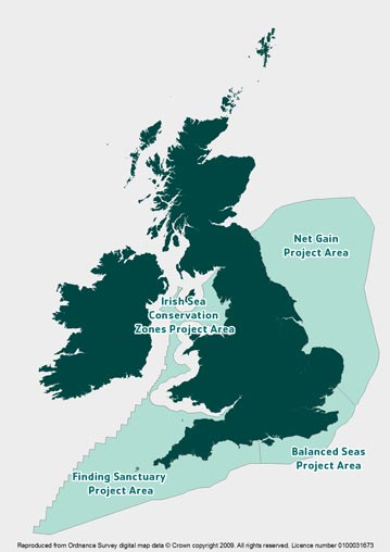
The maps below illustrate the areas that were covered by the Irish Sea Conservation Zones project and our three sister projects around England: Net Gain, Balanced Seas and Finding Sanctuary.

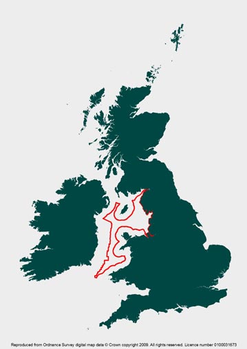
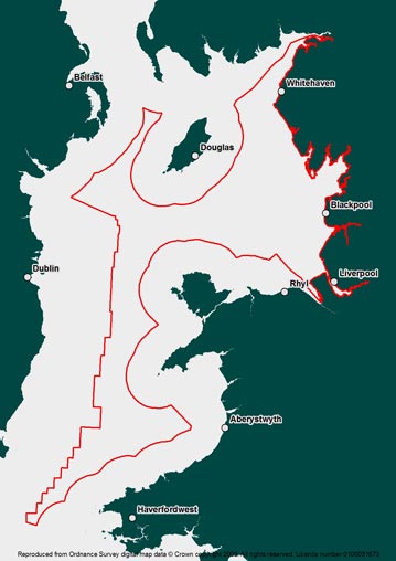
The Irish Sea Conservation Zones project area covered roughly 40% of the entire Irish Sea, or around 18,000 square km.

This included the inshore waters of England, plus the offshore waters of Wales, Northern Ireland and the Isle of Man up to the territorial line with Ireland.

National context

National context map

Project area

Project area map

Irish Sea detail

Project area map (zoomed in)

Feature: 
No

HideHighlights

  • THE FINAL RECOMMENDATIONS FOR MARINE CONSERVATION ZONES IN THE IRISH SEA PROJECT AREA ARE NOW AVAILABLE.  

  • Find out how to contact your spokesperson on the Irish Sea Regional Stakeholder Group.

  • What are Marine Conservation Zones and who recommended them?  

  •  Find out how we are part of wider plans to extend marine protection around the UK and Europe.

  • Our online library helps you find out more about the Irish Sea and our project to recommend new areas of it for protection.